| |
Comment on this article
Tales of the “Un-Fake”
The reputation of a map donated to the Beinecke Library and later suspected of being a fraud has been rehabilitated, but the process highlights the problems of proving a document’s authenticity beyond a doubt.
May 1996
by Jennifer Kaylin
Jennifer Kaylin is a freelance writer whose work appears regularly in the Yale Alumni Magazine.
It was the fall of 1965, and a small group of Yale scholars could barely contain their elation. After months of secrecy, they had just announced receipt of an extraordinary gift, a wrinkled piece of parchment known as the Vinland Map. Hailed as the “cartographic discovery of the century,” the document was said to prove that Leif Ericson, and not Christopher Columbus, was the true discoverer of America. James Tanis, the University Librarian at the time, called the Vinland Map “the most exciting single acquisition of the Yale Library in modern times, exceeding in significance even Yale’s Gutenberg Bible and Bay Psalm Book"; Alexander O. Vietor, Yale’s curator of maps, declared it “the greatest treasure of the Yale Map collection.” To coincide with the announcement, Yale University Press triumphantly published a book, The Vinland Map and the Tartar Relation.
But elation soon turned to mortification. Skeptical of the process used to authenticate the Vinland Map, several scholars called for more sophisticated testing, and in 1972, an investigation by an independent laboratory forced the University to concede that the Vinland Map “may be a forgery,” subjecting Yale to one of the more embarrassing public humiliations in its history.
One would think that an apparent gaffe of this magnitude would have put an end to the saga of the Vinland Map, but last year, yet another group of scientists presented new evidence suggesting that the map was indeed a genuine pre-Columbian document. This finding prompted Yale University Press to publish a revised edition of its original book. The handsome volume arrived in bookstores this February, but not without an introduction conceding that doubts about the map might never be entirely eliminated.
Even the map’s most ardent supporters had been shaken by the on-again-off-again authentication saga, but they were hardly alone. In an era of rapidly changing technology, when frauds abound and even government mints can stay only a step or two ahead of counterfeiters, the people who make decisions about what is real and what is fake are under enormous pressure. That pressure grows even more intense when the object in question has a potential for historic and monetary value. If scholars and scientists using the latest equipment could study the Vinland Map for almost 40 years and still not reach a unanimous conclusion on its authenticity, what does that say about the chances that the genuineness of any artifact can be verified with certainty?
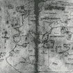
The journey that led to the rehabilitation of the Vinland Map began in 1957, when a New Haven rare-book dealer named Lawrence Witten bought the document for $3,600 from an Italian book seller. To the untrained eye, the map could not have been less impressive. Drawn on a sheet of parchment about the size of a place mat, it had become brownish and rippled with age. There were none of those colorful renderings of mythic sea monsters or the decorative calligraphy one associates with early maps—just a faded and imprecise wavy black outline of several large land masses.
Nevertheless, Witten stopped by the Yale Library to show his acquisition to Alexander Vietor and Thomas E. Marston, the curator of Medieval and Renaissance Literature. Both were impressed by the document, in which they recognized a remarkably accurate representation of Greenland. But next to that was a large area labeled “Vinlanda Insula.” The scholars concluded that the “island” was actually the coastline of North America. Even more intriguing, a Latin inscription in the upper left corner described how Leif Ericson and Bjarni Herjolfson had sailed from Greenland and discovered the new land, which they named Vinland. The scholars concluded that the map had been drawn about 50 years before Columbus’s voyage by an unknown European cartographer using since-lost records left by Viking explorers, and that the discovery itself would have been made about 500 years before Columbus.
Historians had long been aware of Norse sagas about pre-Columbian voyages to North America, but efforts to find any cartographic evidence of these excursions had failed. Suddenly, it appeared to Vietor and Marston, the proof had dropped into their laps.
Alerted to the find, an anonymous donor (who was later identified as Paul Mellon '29, one of Yale’s most durably generous benefactors), purchased the map for $1 million and turned it over to the Beinecke.
Even then, however, the Yale scholars were not without their reservations. Unaccountably, the map had been bound during the 19th century with a medieval manuscript called the Tartar Relation, which related the findings of a 13th-century expedition into Asia to the land of the Tartars. The problem was that the map and the Relation didn’t seem to have anything in common except that they were bound together. To further muddle things, the binding was relatively new, and a cluster of worm holes in the map didn’t match the worm holes in the Relation. Until these disparities could be adequately explained, the authenticity of the map would have to remain suspect.
But in 1958, an amazing stroke of luck seemed to provide the answer. Marston invited Witten over to inspect the bindings of some rare books he'd recently bought from a London company. As Witten leafed through one of the books—a medieval encyclopedia called Speculum Historialia—he noticed that it was made up of an odd combination of parchment and paper pages. Recalling the same feature in the Tartar Relation, he compared the water marks and found that they were the same. He then found that a worm hole on the first page of the Relation exactly matched up with one on the last page of the encyclopedia. Three pairs of worm holes on the map aligned exactly with those on the first page of the encyclopedia. It was therefore clear that the map, the Tartar Relation, and the encyclopedia had once all been parts of the same book—and that evidence contained in the encyclopedia could now be used to authenticate the map.
Eight years of arduous research followed, culminating in the publication of the Press’s lavish book, which described in detail the scholarly and scientific scrutiny to which the map had been subjected. Chester Kerr, who was then the director of the press, has vivid memories of that time. “We planned to publish the book in the spring,” recalls Kerr, “but there was a delay in getting the proofs read, which meant it couldn’t come out until June. I didn’t want it to get lost in the summer, light-reading season, so we decided to wait until the fall.” Kerr and the other major players thought it would be timely to release the book on October 9, Leif Ericson’s birthday, but they decided to wait until the following Monday to accommodate everyone’s schedules. “That was where I made my great mistake, because that turned out to be Columbus Day,” Kerr recalls. “I was always accused of doing this deliberately to discredit Columbus in favor of Leif Ericson, but the truth is that it was a complete accident.”
Angered by what appeared to be an insult to a large population of Italian-Americans, public figures across the country scrambled to register their indignation. Jimmy Durante quipped that although he was not “poissonally” acquainted with Columbus, he knew that when the explorer arrived in America, he “played only to Indians—there were no Norwegians in the audience!” John Lindsay '44, '48LLB, a congressman who was then a candidate for mayor of New York (where Italian-American voters far outnumbered Norse-Americans), declared that “to say Columbus didn’t discover America is as absurd as saying DiMaggio doesn’t know anything about baseball or that Toscanini and Caruso weren’t great musicians.” It wasn’t long before the popular press took up the story, and the combined notoriety helped turn the book into a best-seller.
“It was an amazing time,” recalls Anna Glen Vietor, the widow of Alexander Vietor. “My husband was flooded with phone calls from people asking him why he hated Columbus. Then there were the cartoons: Indians sitting in a circle raising their glasses, saying 'Skoal' as the Santa Maria pulled up to the shore—things like that. If it hadn’t been played up by the media the way it was, it would have been a perfectly good scientific affair.”
But the Columbus Day brouhaha wasn’t the only upheaval the map encountered. At a 1966 conference convened by the Smithsonian Institution to discuss the map, lingering doubts about its authenticity prompted Yale to commission an independent laboratory to reexamine the map. Walter C. McCrone, a Chicago microscopist and expert on air pollution, removed 29 particles of vellum and ink from the map. His X-ray analysis showed that the particles consisted of anatase, a crystalline form of titanium dioxide that is rare in nature—and was not commercially available as a white pigment until 1920. Devastated, but facing what appeared to be incontrovertible scientific evidence, Yale conceded that the map might be a fake.
As horrifying as this episode was for Yale scholars, they might have taken comfort in the knowledge that they were in good company. History is littered with examples of suspected and confirmed forgeries, not to mention revisionist discoveries. Experts are still debating the authenticity of the Shroud of Turin, the cloth supposedly used to wrap the body of Christ after he was taken down from the cross and which is said to bear his image. More recently, a statue that stood unnoticed for years in the lobby of a stately New York City home designed by Stanford White for the Payne Whitney family has been reassessed by at least one reputable scholar as a work by Michelangelo.
More common are forgeries that were ultimately exposed. Euripides, Themistocles, and Socrates are just three ancient writers whose letters and works were forged. In the late 18th century, William Henry Ireland claimed to have discovered unknown manuscripts by Shakespeare, going so far as to create a new “Shakespeare” play, Vortigern and Rowena. In 1928, the Atlantic Monthly published a series of articles based on what turned out to be forged love letters from Abraham Lincoln to Ann Rutledge. The “diaries” of Benito Mussolini even fooled his son, Vittorio, and the forging of Howard Hughes’s autobiography by Clifford Irving was only exposed when the reclusive billionaire emerged from seclusion to denounce its authenticity.
One of the more spectacular American forgery cases involved a con artist named Mark Hofmann, who sought to rewrite Mormon theology by creating bogus documents that included the so-called “White Salamander Letter,” which described the finding of the “gold plates” on which Mormonism is founded. But perhaps the most dramatic forgery attempt of modern times occurred in 1983 with the appearance of 62 diaries supposedly written by Adolf Hitler. The West German photo weekly Stern paid $3.8 million before discovering its error, and Newsweek magazine was left red-faced after it devoted a cover story to what turned out to be total fabrications.
These examples, of course, all involve forgeries that were eventually exposed; the case of the Vinland Map differs in that it could well be authentic. This makes its story all the more intriguing, and the detective work of the scholars assigned to unravel the mystery that much more difficult.
When investigating a document like the Vinland Map, experts use a combination of science and scholarship, drawing on historical evidence as well as physical data. Improved technology—high-powered microscopes, ultraviolet light, micronometers, X-rays, and cyclotrons are but some of the tools—now enables scientists to expose fraudulent artifacts with greater ease, but a thorough knowledge of the culture in which the item was supposedly produced is also essential. For example, scholars were immediately suspicious of a notebook that was purportedly the diary of Jack the Ripper because it contained phrases inconsistent with Victorian prose. The simple fact that the diary was written in the sort of scrapbook usually used for mounting postcards and photographs rather than recording personal histories added to the doubts, which were eventually confirmed.
Jacqueline Olin of the Smithsonian Institution’s Conservation Analytical Laboratory says teamwork is often critical to authenticating an artifact. Just as an assortment of health-care specialists will work together to diagnose a disease and develop a course of treatment, experts representing a range of different fields will join forces to analyze a questionable document. In his book, Forging History, Kenneth W. Rendell writes that the “authentication of historical letters and documents uses an analytic approach that can be illustrated and proven. It is true that an initial element that many call 'intuition' does play an important part in any examination of questioned documents; but what is frequently called intuition is a simultaneous observation of combinations of facts reflected against the mental images stored during decades of experience, giving an indication of whether the document in question meets the general criteria of genuine documents of the period and circumstances.” Rendell adds that “knowing the psychology of forgers is almost as important as knowing how to analyze handwriting.”
The case for and against the Vinland Map has always hinged on the scientific evidence, but the ways in which that evidence is gathered and evaluated are constantly changing. McCrone’s technical data, gathered in the early 1970s, seemed at the time to be definitive. As time passed, however, a challenge to the original results became all but inevitable. When it happened—at the behest of a group of supporters who remained unwavering in their belief that the map was authentic—no one was sure what the result would be. But in 1985, the pro-Map forces got the news they had been hoping for. Physicists at the University of California at Davis had uncovered new evidence that contradicted McCrone’s findings and tipped the scale back toward the view that the document was genuine.
Using a powerful cyclotron to fire a beam of protons through the map, the UCD team had generated X-rays from which all elements present in the ink and parchment could be identified and quantified. Thomas A. Cahill, who headed the project, reported that the ink contained only trace amounts of titanium, amounts consistent with other medieval documents he had studied. “We tested 150 parchment documents from that period, and the findings were similar,” he says.
Another McCrone finding that had hurt the map’s claim to authenticity was that the anatase appeared in the form of crystals, rather than in the irregular chunks and shards that are found in nature. Cahill acknowledges the point, but argues that the condition is likely to be the result of modern contamination rather than a modern forgery. “Such particles could be easily pressed into the map during handling,” he says. “This is in fact almost impossible to avoid.” As for McCrone’s contention that the anatase was used to make the map’s yellow lines, Cahill says experiments proved it was not present in sufficient quantities to produce visible marks.
McCrone, who has also tested the Shroud of Turin and is convinced that it is a forgery, stands by his position that the Vinland Map is “a modern production.” In a dramatic gesture emphasizing just how heated the argument has become, McCrone showed up, uninvited, at a symposium held at Yale on February 10 to discuss the map. McCrone remained silent throughout, but when the symposium ended he handed out a copy of the report he said he would have submitted had he been asked. It was titled: “The Vinland Map, Still a 20th-Century Fake.” Among McCrone’s supporters is Kenneth M. Towe, a senior research geologist at the National Museum of Natural History. “Cahill’s instrument can find an element like titanium dioxide, but not a mineral, such as anatase,” Towe says. “It’s like having an instrument capable of detecting carbon but not being able to tell whether it’s graphite or a diamond.”
How can reputable scientists and scholars reach such contradictory conclusions? If authenticating an artifact were an objective science, devoid of the capriciousness of human emotions and free from the vagaries of interpretation, consensus might be easier to reach. But bias, ego, emotion, even wishful thinking—in short, the human factor—are very much a part of the equation. “People think that scientists, with their white lab coats, are not subject to human frailties,” says Wilcomb Washburn, director of the American Studies Program at the Smithsonian Institution. “But human emotions do affect their considerations of the truth.”
The probing is not over yet. The results of a carbon-14 dating test performed on the map are expected later this year.
It would be an understatement to say that the Vinland Map has been subjected to an unprecedented amount of controversy and study. It has aroused the passions of both scientists and historians, who remain divided over its authenticity, and even its advocates are forced to hedge their bets. Back in 1965, when the first Vinland Map book was published, Alexander Vietor wrote that it was designed to be a “preliminary worka springboard for further investigation.” More than 30 years later, Washburn remains similarly circumspect. In the book’s second edition, he writes that while the dispute over the map’s authenticity may never be resolved, it “can now be said to have reached a new stage.” Those who have been charging forgery “must now assume a defensive role and respond to those previously on the defensive.”
Given such lingering doubts, it might seem surprising that Yale University Press would release a second edition of The Vinland Map and the Tartar Relation, which stops just short of declaring the map genuine. Despite the risk of another catastrophe of credibility, Press Director John Ryden says he had no qualms about publishing the revised work. “To the extent possible, the people involved have been vindicated,” he says. “All the apparently damning evidence was overturned, which led us to conclude that the map had received a bum rap.” Ryden also knows that scholars and scientists are limited in what they can do to authenticate a historic artifact. “You can never prove authenticity; you can only disprove it,” he says, adding philosophically, “secretly, I feel that to leave a little bit of mystery is probably a good thing.”  |
|